The Portuguese Bend community is one of the most beautiful, and in my opinion the most coveted areas in which to live anywhere between Santa Barbara and San Diego. This page is divided into a couple of sections. If you’re new to Portuguese Bend, the this first section reviews the history and a speaks toward the ambiance of the area. Then at the bottom of this page you can actually search for homes for sale and review closed sales that have occurred in the community. Don’t be surprised if there isn’t much for sale … When you live here, you really don’t ever want to move away!

Portuguese Bend
The Portuguese Bend region is the largest area of natural vegetation remaining on the Palos Verdes Peninsula, in Los Angeles County, California. Though once slated for development (and in fact the projected route of Crenshaw Boulevard through the area still shows on many maps), some Portuguese Bend areas are geologically unstable and as such are unsuitable for building. However other parts of Portuguese Bend have been deemed geologically stable and in fact new construction is occurring. The geologic profile of the area however is what is an enormous “silver lining” to the stigmatized dark cloud in that it makes Portuguese Bend the beautiful and tranquil community that it is. Portuguese Bend homes reside within the only gated community in Rancho Palos Verdes.
The geographical location and geological history of the peninsula make the remaining habitat extremely valuable for ecological and other scientific reasons. The peninsula, which was an island with the Palos Verdes Hills in recent geological time, has close floral and faunal similarities to the Channel Islands. This feature makes the Portuguese Bend Landslide area a natural research laboratory for the study of island biogeography and evolutionary ecology.  Surrounding the Portuguese Bend homes area is the Portuguese Bend Reserve which is filled with hiking trails and is nearly 400 acres in size.
The Portuguese Bend Reserve consists of rolling hills, five distinct steep canyons and rock outcrops, with coastal sage scrub habitat, a community of intensely fragrant and drought resistant shrubs and flowering plants. Located below and to the east of Del Cerro Park are the areas known as Lemonadeberry Parcel, Eagle’s Nest, the Badlands, and the active landslide and dirt extension of Crenshaw Boulevard. Unique features include a pillow lava outcrop called Ailor Cliff after Conservancy founder Bill Ailor.
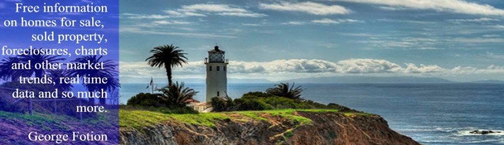
The vegetation found in the area is coastal sage scrub. This plant community supports a surprising number and variety of species. There are at least three races of birds resident on the peninsula that are found nowhere else except the Channel Islands. These are the insular forms of the Orange-crowned Warbler, Pacific-slope Flycatcher, and Allen’s Hummingbird. The same phenomena has been documented for plant species. A species of live-forever, Dudleya virens, which is endemic to the Channel Islands and the Palos Verdes Peninsula, is found near Point Vicente Light a Lighthouse built in 1926.
The area also serves as habitat to many migrating birds moving through the region in fall and spring. The Peninsula is a headland that juts into the Pacific Ocean several miles further than the surrounding coastline. Migrating terrestrial and shore birds, flying over the open ocean on their north-south migration along the Pacific Flyway, spot this headland and stop to rest and feed. Many of these birds will stay and spend the winter in the area. Thus, the geographic position makes this habitat much more important than might otherwise be expected.
Portuguese Bend History
Native Americans: The peninsula was the homeland of the Tongva-Gabrieliño Native Americans people for thousands of years. In other areas of the Los Angeles Basin archeological sites date back 8,000 years. Their first contact with Europeans in 1542 with João Cabrilho (Juan Cabrillo), the Portuguese explorer who also was the first to write of them. Chowigna and Suangna were two Tongva settlements of many in the peninsula area, which was also a departure point for their rancherias on the Channel Islands. Legend has it that the Native Americans blessed the land of Palos Verdes, making it the most beautiful place on Earth.
Spanish and Mexican era: In 1846 Jose Dolores Sepulveda and José Loreto received a Mexican land grant from Alta Governor Pío Pico for a parcel from the huge original 1784 Spanish land grant Rancho San Pedro of Manuel Dominguez.[6] It was named Rancho de los Palos Verdes, or “ranch of the green sticks”, which was used primarily as a cattle ranch.
American era: By 1882 ownership of the land had passed from the Sepulveda through various mortgage holders to Jotham Bixby of Rancho Los Cerritos, who leased the land to Japanese farmers. Early in the 20th century most of Bixby’s land was sold to a consortium of New York investors who created The Palos Verdes Project and began marketing land on the peninsula for small horse ranches and residential communities. Portuguese Bend homes enjoy a price appreciation premium above and beyond similar Palos Verdes homes.

The whaling era: The name Portuguese Bend comes from the whaling activities of Portuguese whalemen from the Azores. An Azorean shore whaling captain named José Machado brought shore whaling to this bend in the coastline north of San Pedro Bay after the closure of the San Pedro Bay whaling station on Deadman’s Island in or about 1862. He brought with him a crew of Azorean whalemen. In 1864, Captain Clark moved his operations to San Simeon Bay. In 1869, the station was operated by the John Brown Whaling Company (Los Angeles Star, March 13, 1869). In 1874, Captain Frank Anderson (né Anasio) brought a crew from Port Harford in San Luis Obispo County. His operation at Portuguese Bend lasted from 1874 to 1877. During three winters (December–April) he obtained 2,166 barrels of oil from trying out the blubber flensed from gray whales he had caught on their annual migration along the California coast. He abandoned the station thereafter, establishing another further north at Pigeon Point. An 1888 U.S. Fish Commission Report stated that whales had been caught from Portuguese Bend as late as 1884, suggesting another party utilized the area for whaling up until that date.
The Vanderlip era: Frank A. Vanderlip, Sr. (November 17, 1864 – June 30, 1937) was known as the “Father of Palos Verdes”. He purchased the 16,000 acre Rancho de los Palos Verdes from Jotham Bixby in 1913. In 1916, he built the Vanderlip estates near the Portuguese Bend area of Palos Verdes, California. His descendants still live in the mansion and on other parts of the property. His daughter-in-law Elin Vanderlip maintained residence at the estate until her death in 2009 and her ashes are spread on the grounds. The Vanderlips championed many of the landmarks in Rancho Palos Verdes, notably Wayfarers_Chapel (The church was designed by Lloyd Wright (son of Frank Lloyd Wright) in the late 1940s and was built between 1949 and 1951.), Marineland of the Pacific, Portuguese Bend Riding Club (featured in the movie Chinatown), Marymount College, Palos Verdes and Chadwick School. In 1949 Frank Vanderlip Jr. built the Portuguese Bend Beach Club (a gated beach house community The houses were built on lots leased for 25 years and were the typical 1940s weekend places where people went to have a quiet time at the beach. Back then there was a clubhouse, restaurant, paddle tennis courts, 50 foot swimming pool, a sandy beach, and a 485 foot long pier where boats could tie up.
Portuguese Bend homes for sale and Portuguese Bend home sales
follow this link back to the original content for this post by clicking the image here:

+George FotionGeorge Fotion on Google+
